3RY – Part 6 – Day 48

3RY Update Part:

6

Date:

11th March ‘19

Day:

48

Title:

Birdsong – Coast to Coast 2.

KM Mark Start:

2153.5

Start Location:

Greyneys Shelter

KM Mark Finish:

2126

Finish Location:

Kiwi Hut

Actual KM today:

34

Weather:

Overcast few spots of rain

General:

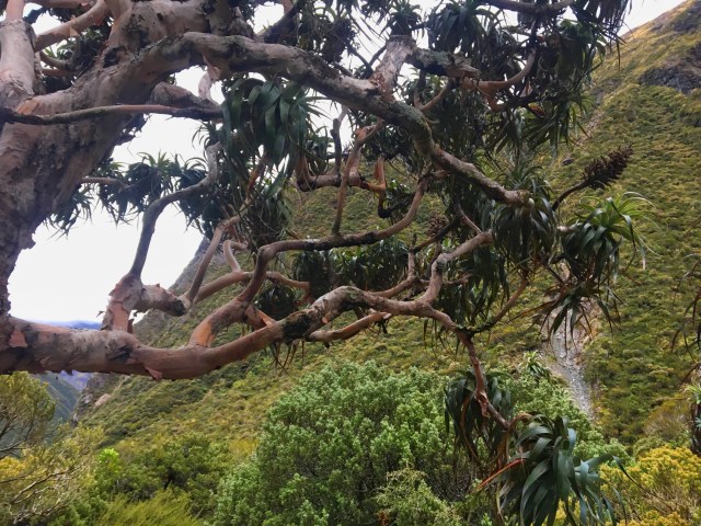
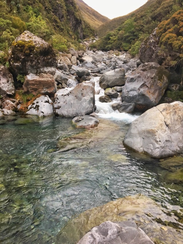
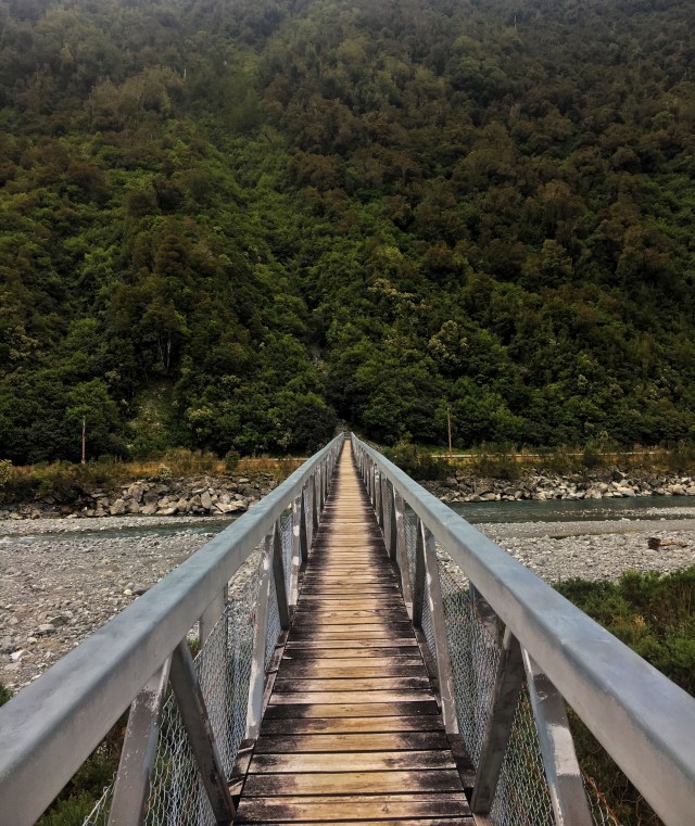
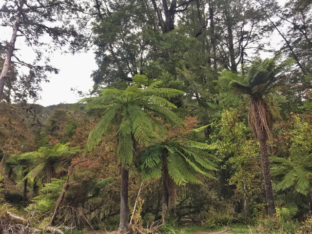
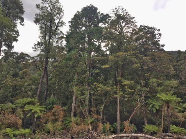
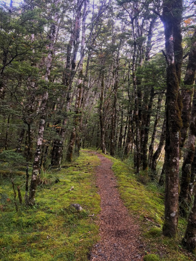
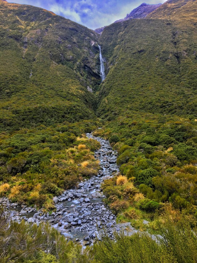
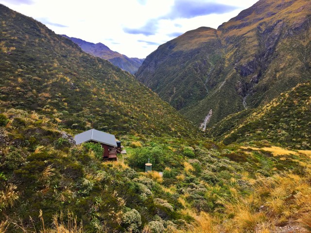
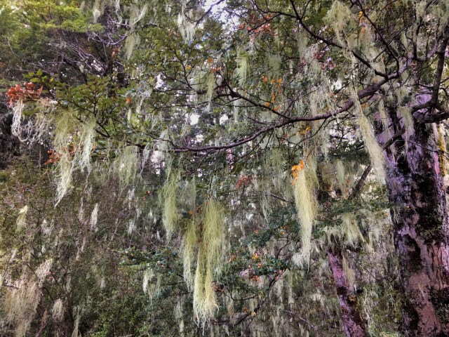
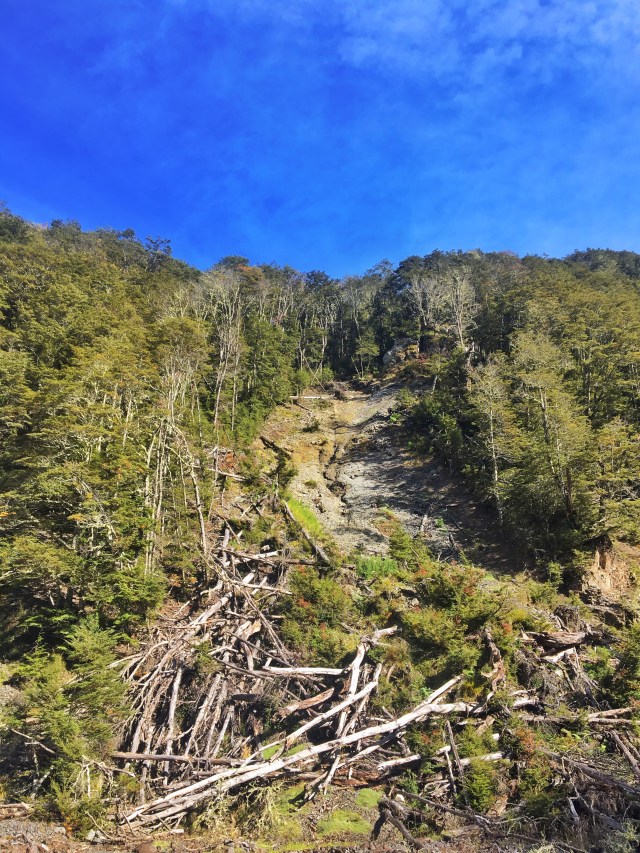
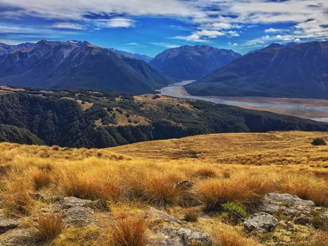
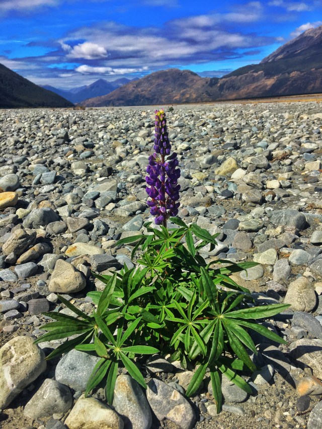
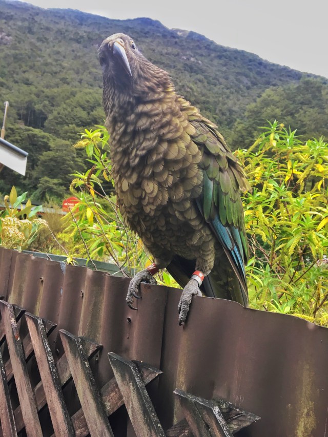
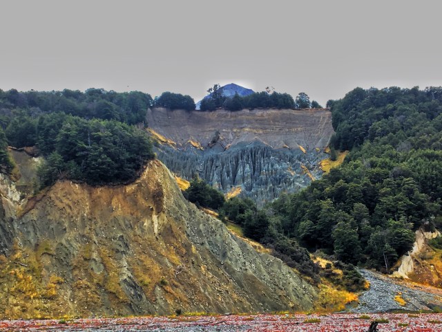
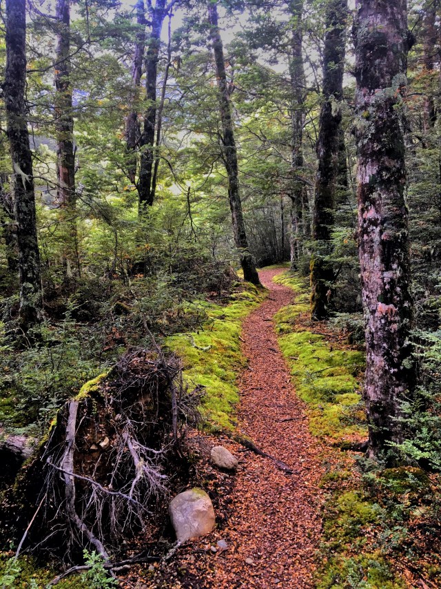
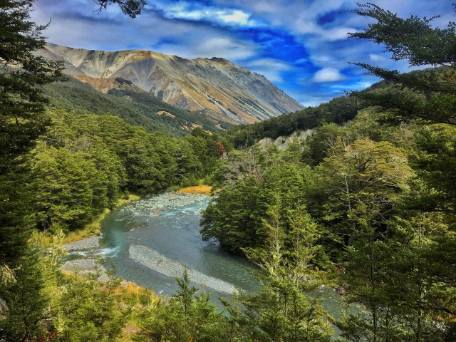
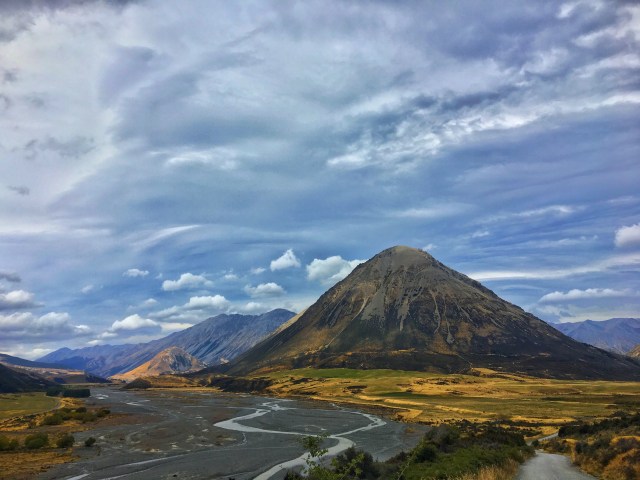
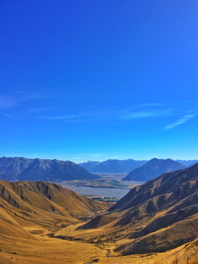
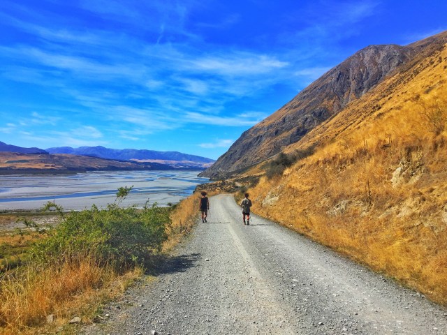
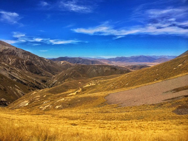
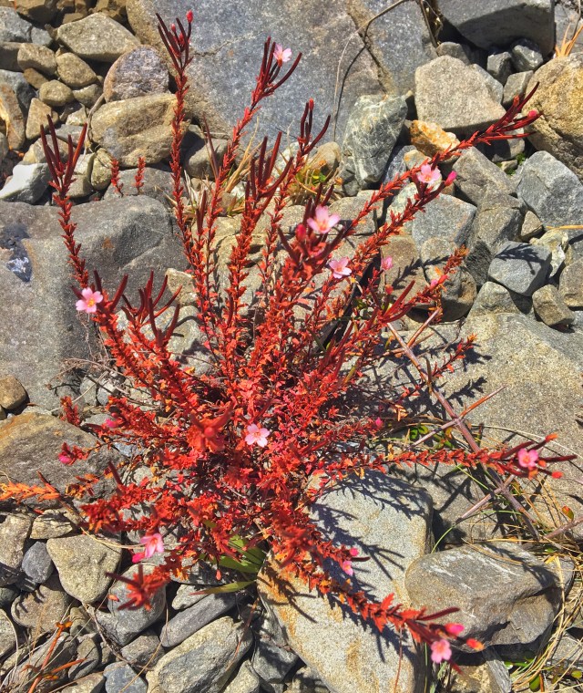
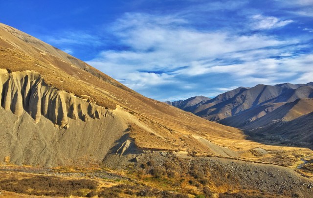
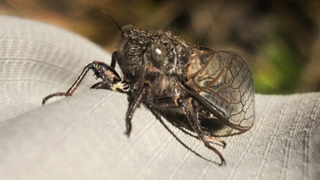
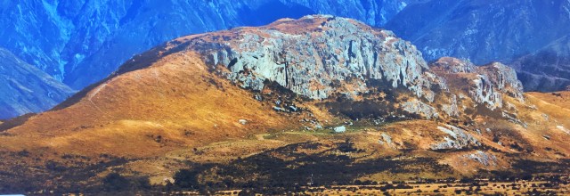
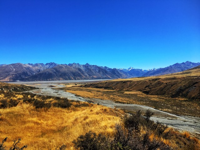
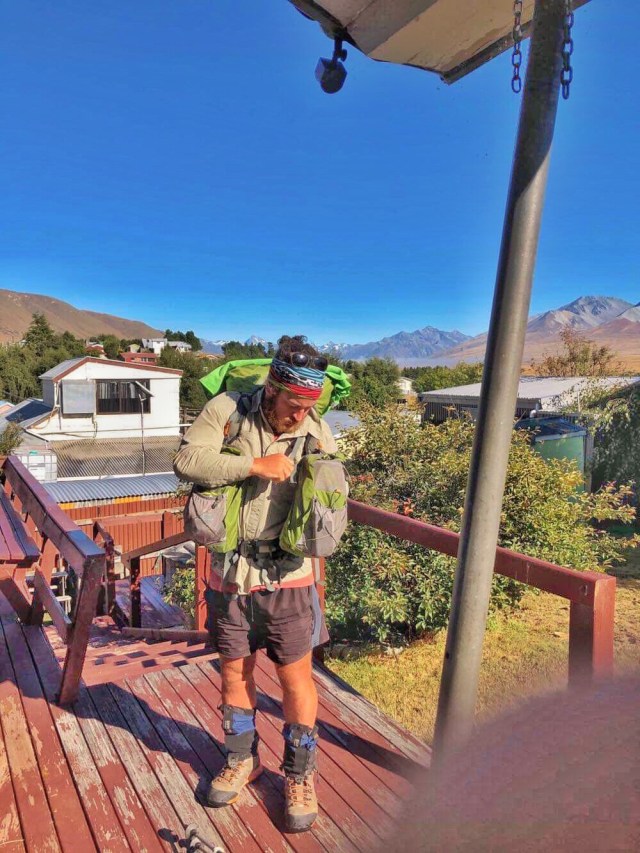
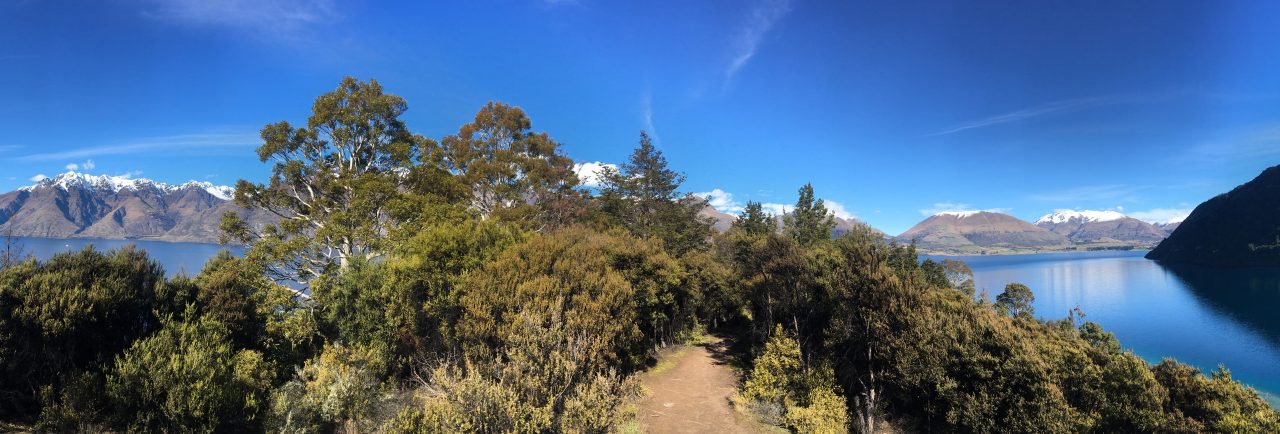
Early start in the hope of seeing some wildlife out and about. The trail followed Deception Valley and Deception River (named so, due to the deceiving amount of water it carries after a good rain). This is the 2nd day of two that follows the ‘Coast to Coast’ route, up and over Mingha & Deception Valley. A helicopter dropped ~14 DOC trap setters, staggered at various locations up the valley. I ran into them every now and then on the trail. It was slow progress to start with, boulder hopping, scrambling in, out and around the river. Incredible scenery, so my pace didn’t worry me. Was planning on stopping at Morrison’s Footbridge to set up camp but pushed on via Otira River and then Taramakau River to Kiwi Hut. Spotted more birdlife than I have so far on this trip; Kea, Robbins, Tomtits, Fantails Rifleman, Wood Pigeon, Weka, Tui, & Bellbirds. Enjoyed seeing the Weka and Kea in the bush away from civilisation. Can hear the kiwi calling but haven’t seen any.

Body/Health:

Goooood, yup.

Outlook:

Positive. Want to get to Locke Stream hut by the time the rain comes.

Tune of the Day:

Redemption Song – Bob Marley

Day 48 Images:

3RY – Part 6 – Day 47

3RY Update Part:

6

Date:

10th March ‘19

Day:

47

Title:

Coast to Coast 1

KM Mark Start:

2164

Start Location:

Greyneys Shelter

KM Mark Finish:

2153.5

Finish Location:

Goat Pass Hut via Mingha Bivouac

Actual KM today:

15

Weather:

Overcast

General:

Had stayed in Arthur’s Pass last night so needed to hitchhike back to where I’d left the trail yesterday.

Followed Mingha River up over Dudley’s knob then onto Mingha Track, to take me to Goat Pass and then Goat Pass Hut. This is the 1st day of two that follows the ‘Coast to Coast’ route, up and over Mingha & Deception Valley.

Lots of really curious Robins and Tomtits on this part of the trail. Some impressive waterfalls along the way as well. This is Kiwi territory but haven’t been lucky enough to spot one as yet!

Body/Health:

Good – enjoyed the short day.

Outlook:

Positive

Tune of the Day:

Santa Monica – Everclear

Day 47 Images:

3RY – Part 6 – Day 46

3RY Update Part:

6

Date:

9th March ‘19

Day:

46

Title:

Irresponsible Ruth

KM Mark Start:

2188

Start Location:

Hamilton Hut (Hamilton Hilton)

KM Mark Finish:

2164

Finish Location:

Greyneys Shelter Via Lagoon Saddle A-Frame and Hut, Bealey Hut, Waimakariri River, Klondike Shelter.

Actual KM today:

28

Weather:

Sunny with a few clouds

General:

Headed down the Harper River ducking in and out of beech forest and the river itself. These areas are looked after by DOC, so tracks are well marked. I had decided to follow the river rather than the DOC trail through one section and ended up at a dead end with a waterfall. I was able to climb the rocks to one side of the waterfall but couldn’t manage it with my pack on. Rather than back tracking I took each item of my kit up one piece at a time and threw them onto the upper ledge. I was then able to just climb myself up and over to collect my things.

Made good time to Lagoon Saddle where you could see the Waimakariri River and Bealey River Confluence. After that, it was all downhill to Cora Lynn Carpark. The planned route from here was to road walk over the Bridge and around to Greyneys Shelter (near Arthur’s Pass), but Irresponsible Ruth had other plans and suggested I cross the Mighty Waimak. I headed down to see if it was doable and it was very low, so managed it with no dramas. The night was spent in Arthur’s Pass with a group of 5 Juvenile Keas flying around causing havoc with peoples belongings. Man I love these birds, the trail of carnage they leave behind cracks me up. Saw one destroying a surfboard on the roof of a car and another took the volume control off my Lifeproof case…not Kea proof.

Body/Health:

Good

Outlook:

Positive. Looking forward to Hanmer Hotpools!

Tune of the Day:

Under the Bridge – Red Hot Chilli Peppers

Day 46 Images:

3RY – Part 6 – Day 45

3RY Update Part:

6

Date:

8th March ‘19

Day:

45

Title:

Floating Tents

KM Mark Start:

2207

Start Location:

Harper River Campsite

KM Mark Finish:

2188

Finish Location:

Hamilton Hut (Hamilton Hilton)

Actual KM today:

21.4

Weather:

Overcast

General:

Last night was craaaazy. By far the worst overnight weather conditions I’ve had on the trail. Gail force winds continued and heavy rain came. The campsite had 6cm of pooling surface water. The tent floor was floating. It felt like a water bed. The three others that were at the campsite had their tents blown over and two slept in the campsite toilet for shelter. When the pegs went into the ground earlier that day it was very hard, after the rain, the ground turned to soft mud and the pegs wouldn’t hold in the winds. I only had one peg come out (I’d placed rocks on them) and was stoked the tent held up and didn’t flood.

I thought the rivers might be in flood after the nights heavy rain, so wasn’t really sure what I’d be in for today. Turned out to be a nice easy walk to Hamilton Hut. Loads of river crossings but nothing too treacherous. Hamilton hut is known as the Hamilton Hilton due to its little luxuries. Running water, nice deck, cast iron wood burner etc. My bed was right beside a window so I was able to stargaze while I drifted off. Tempted to stay another day but have made plans to meet people further north so will push on tomorrow. The geological formations in the images below (grey materials) are known as The Pinnacles. These tall, cone shaped pillars are formed by a more resistant material on top preventing the less resistant material directly underneath the ‘resistant cap’ from being eroded away.

Body/Health:

Good

Outlook:

Positive

Tune of the Day:

One Love – Bob Marley

Day 45 Images:

3RY – Part 6 – Day 44

3RY Update Part:

6

Date:

7th March ‘19

Day:

44

Title:

Head Winds and Grumpy Farm Boys

KM Mark Start:

2233

Start Location:

Coleridge Village

KM Mark Finish:

2207

Finish Location:

Harper Campsite

Actual KM today:

30

Weather:

Overcast and gale force winds

General:

The feature of today was definitely the wind. It was strong, and slowed me down something wicked. Witnessed a few road/DOC signs and large trees blown over with the force of it. It whipped the finer materials around giving my face and legs a good sand blasting. People passing me in vehicles up until this point have all been Uber friendly, slowing down, giving a smile and a wave and some stopping to ask questions or offer lifts. Today must’ve been a bad day for the local farm boys, they were all pretty dark on it! Even the nationally accepted minimum, a steering wheel finger lift was too much for ‘em 😆

The route went initially through the Hart Arboretum. It continued west of Kaka Hill, then past Lake Georgina, Lake Evelyn, Lake Selfe, Lake Henrietta and eventually to Harper River Camping Area. Just managed to get the tent up before the rain! Yussss.

Body/Health:

Good

Outlook:

Positive – fingers crossed the rain doesn’t raise rivers too high for my next section to Arthur’s Pass.

Tune of the Day:

The sound of silence – Disturbed.

Day 44 Images:

3RY – Part 5 – Day 43

3RY Update Part:

5

Date:

6th March ‘19

Day:

43

Title:

Methven Zero

KM Mark Start:

2233

Start Location:

Methven

KM Mark Finish:

2233

Finish Location:

Methven

Actual KM today:

0

Weather:

Sunny

General:

Zero day! Spent the day sorting upcoming accommodation, resupply boxes, gear repairs, fine tuning & lightening the kit.

Body/Health:

Rested

Outlook:

Positive, some big stretches coming up.

Tune of the Day:

Jurass Finish First – Jurrasic 5

Day 43 Images:

3RY – Part 5 – Day 42

3RY Update Part:

5

Date:

5th March ‘19

Day:

42

Title:

Yeeeeeeew!!

KM Mark Start:

2245

Start Location:

A-Frame Hut

KM Mark Finish:

2233

Finish Location:

Lake Coleridge Village

Actual KM today:

28

Weather:

Sunny and hot

General:

Easy walk from A-Frame Hut to the car park on Double Hill Road. Epic views overlooking the Rakaia River and Wilberforce River confluence. Had the company of Kina, a fellow hiker, for the much anticipated river crossing. This crossing was the last and most troublesome of all the water bodies that required a work-around in the South Island. As I’ve mentioned in previous posts…(Anyone that’s doing the TA and considering this, I recommend you don’t. I had a number of safety measures in place that made it possible, including people keeping watch onshore)

It took around three hours to cross and the flow was swift. When the worst of the channels had been ticked off we were able to relax a little and use the smaller channels to float downstream to some old 4WD access locations. These allowed us to gain access to the Coleridge power plant and then Lake Coleridge Village itself.

The days support crew and great friends of mine (Will and Ruth), had come to meet us with beers and fresh fruit! THE best watermelon I’ve ever had. Thanks guys!

Body/Health:

Good

Outlook:

Happy I have the South Island rivers done and dusted! Whoop whoop.

Tune of the Day:

Scenario – A Tribe Called Quest

Day 42 Images:

3RY – Part 5 – Day 41

3RY Update Part:

5

Date:

4th March ‘19

Day:

41

Title:

Cicada Storm

KM Mark Start:

2268

Start Location:

Double Hut

KM Mark Finish:

2245

Finish Location:

A-Frame Hut via Comyns Hut

Actual KM today:

28

Weather:

Sunny and hot

General:

Followed the gnarly, tussock filled gullies up to Clent Hills Saddle.

After which it was a slow, difficult descent to Round Hill Creek. Going gets tough when the scree slopes are overgrown with Matagouri, Tussock & Spaniard Grass. Every step your foot can potentially (& often does) end up between the gaps in the rocks. It becomes more like feeling your way down the slope than walking it. River crossings all day (30+) until Comyns Hut, which is a few KM’s after Round Hill Creek meets the North Branch Ashburton River.

Maori Cicadas (that’s what they are called) in their thousands today (See photos). It’s like walking through a hail storm. They fly kamikaze styles at you & the ones that manage to land make a hell of a racket.

Most of the dark-coloured Maoricicada species live in alpine habitats or other bare, rocky sites. This one, Maoricicada mangu, is distributed east of the main divide from the Kaikōura mountains to Tekapo and the Mackenzie Pass area. Nowhere else in the world do cicadas live in such rocky, mountainous zones.

The spider in the image is known as a Vagrant/Prowling Spider.

A curious NZ falcon watched me as I left the hut in the morning too.

Body/Health:

Good, legs felt a little better today.

Outlook:

Positive, fingers crossed for weather and Rakia Crossing

Tune of the Day:

Kashmir – Led Zeppelin

Day 41 Images:

3RY – Part 5 – Day 40

3RY Update Part:

5

Date:

3rd March ‘19

Day:

40

Title:

It’s gettn’ hot’n hur.

KM Mark Start:

2298

Start Location:

Lake Clearwater Batch

KM Mark Finish:

2268

Finish Location:

Double Hut

Actual KM today:

32

Weather:

Sunny and Hot!

General:

Was hesitant to leave such a comfy setup at Lake Clearwater, but a cooked brekky and strong coffee helped get me out the door!

Followed the Hakatere Potts Road out to Hakatere where I found some historical buildings and a rad visual and audio display explaining the wildlife of the region and some historical interviews with people of the area. Worth a look if you’re passing through.

From the historical buildings it is a long dry stretch until the Ashburton/Hakatere River Bridge where I went for a dip…so clean and so fresh.

Passed east of Maori Lakes, into

some visually breathtaking country. The people that miss this section of Te Araroa (& plenty do) are missing out. Passed Lake Emily, Manuka Lake and finally Seagull Lake to arrive at Double Hut (via Manuka Hut), my destination for the evening. Nice Hut with the South branch of Swin River running alongside. Killer sunset and views of Lake Heron to the west.

Body/Health:

Need a few shorter days, my legs are starting to seize up a little @ the end of the day.

Outlook:

Positive

Tune of the Day:

Titanium – David Guetta (Feat. Sia)

Day 40 Images:

3RY – Part 5 – Day 39

3RY Update Part:

5

Date:

2nd March ‘19

Day:

39

Title:

Clearwater

KM Mark Start:

2305

Start Location:

Potts Lodge

KM Mark Finish:

2298

Finish Location:

Lake Clearwater Batch

Actual KM today:

16.7

Weather:

Sunny

General:

Was going to have a zero day at Mount Potts but heard I had some relations staying at their batch in Lake Clearwater! The planned route was slightly north of the lake so I decided to walk south and catch up with some fam and some friends they had staying with them.

Best decision ever… Beers, ice creams, massive home cooked meals, rubix cube algorithms, historical geology letters, star gazing, seeing the family again, meeting their mates, great chat and even better company.

Thanks guys! I’ll be back, even if it’s just so I can sign the visitors book again!

For any of you movie buffs out there, the image below is Mount Sunday, which is ‘Edoras’ in the Lord of the Rings Movies. Found at Mt Potts Station.

Body/Health:

Ok, few niggles, nothing major.

Outlook:

Hard to leave such an enjoyable, comfy spot but great for a break.

Tune of the Day:

Regulate – Warren G

Day 39 Images: